

Marine charts
Official NOAA nautical charts — depths, shoals, and aids to navigation — as a map layer. Live, or fully offline for boat trips.
The chart imagery covers Kuskokwim Bay and all US waters, and comes from NOAA through the QSAR server.
iTAK works with files, not URLs — both iPhone paths below start by downloading a file to the phone, then picking it from inside iTAK. Fastest way: scan the QR codes below with the phone camera — scanning downloads the file directly.
iPhone (iTAK) — live charts (needs connectivity)
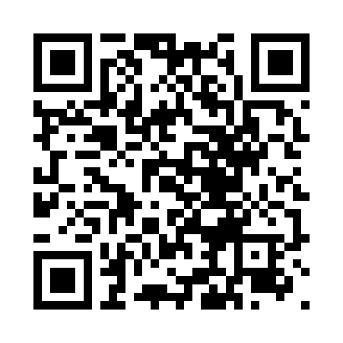
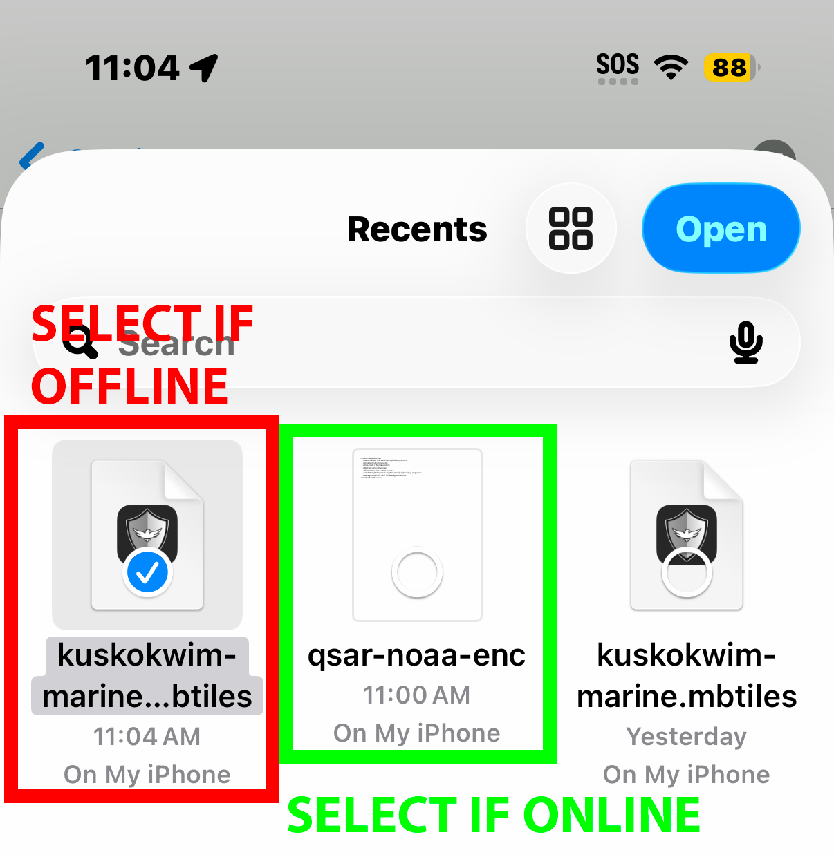
- Scan the QR above with the phone camera (or open https://tak.qsartak.org/offline/qsar-noaa-enc.xml) — the file downloads to Files → Downloads.
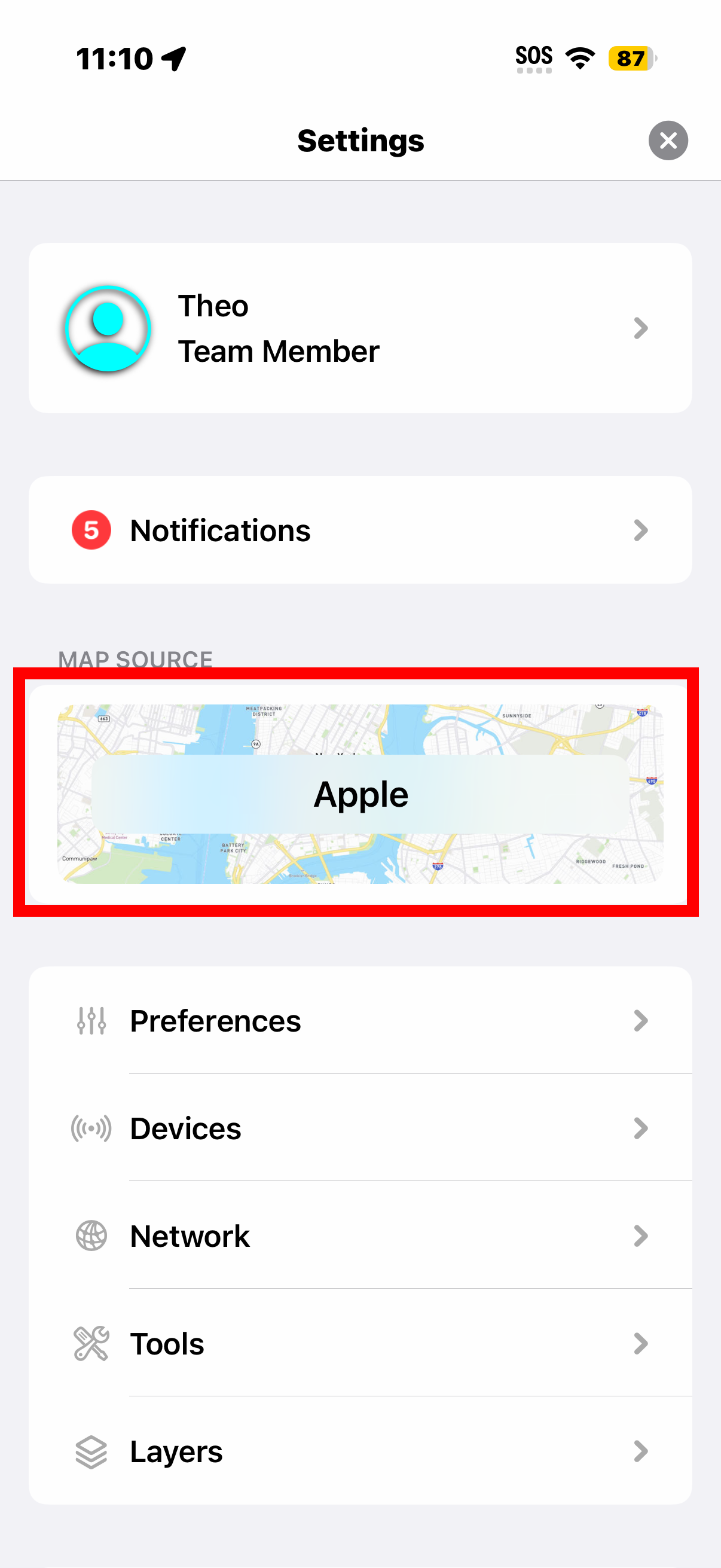
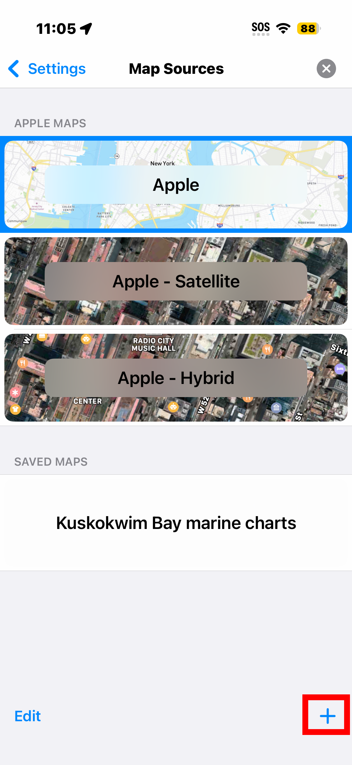
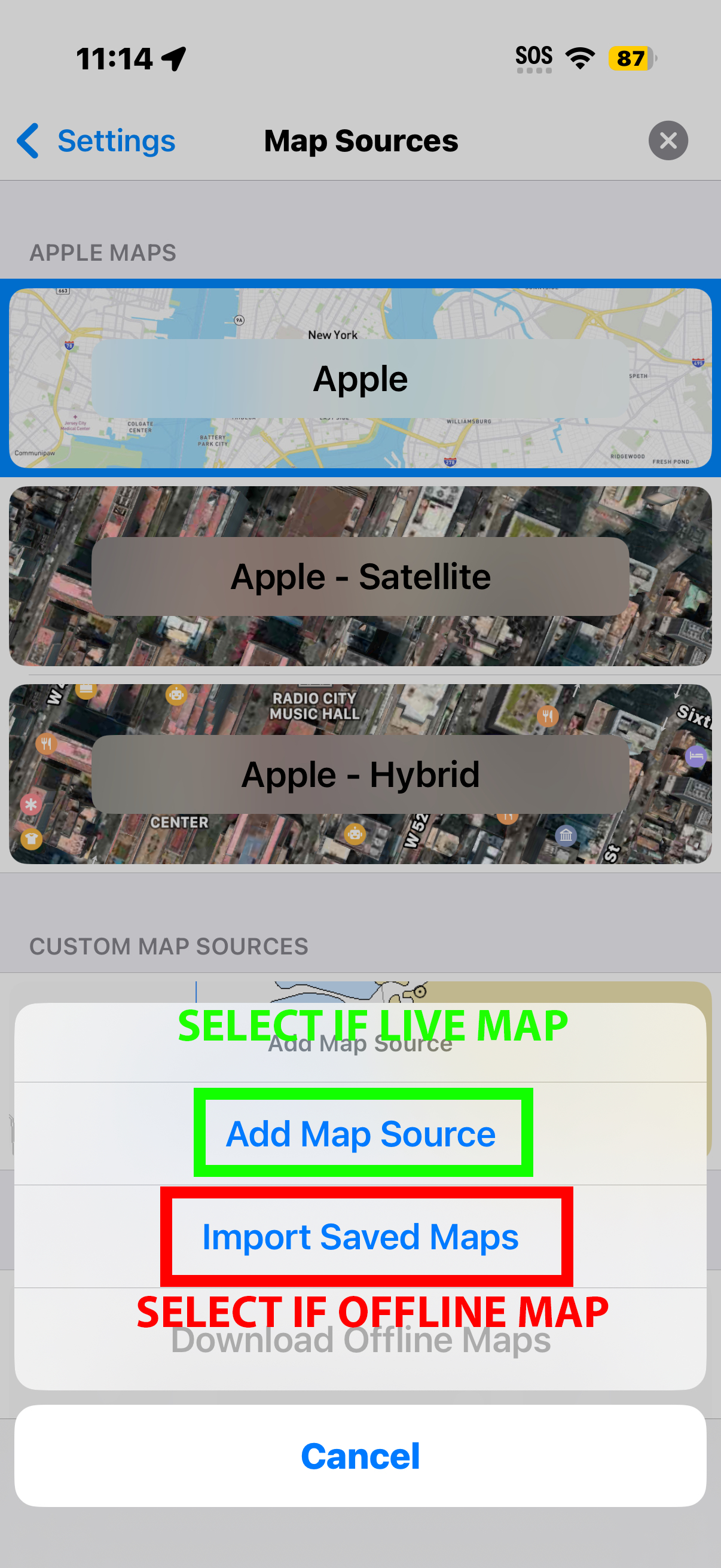
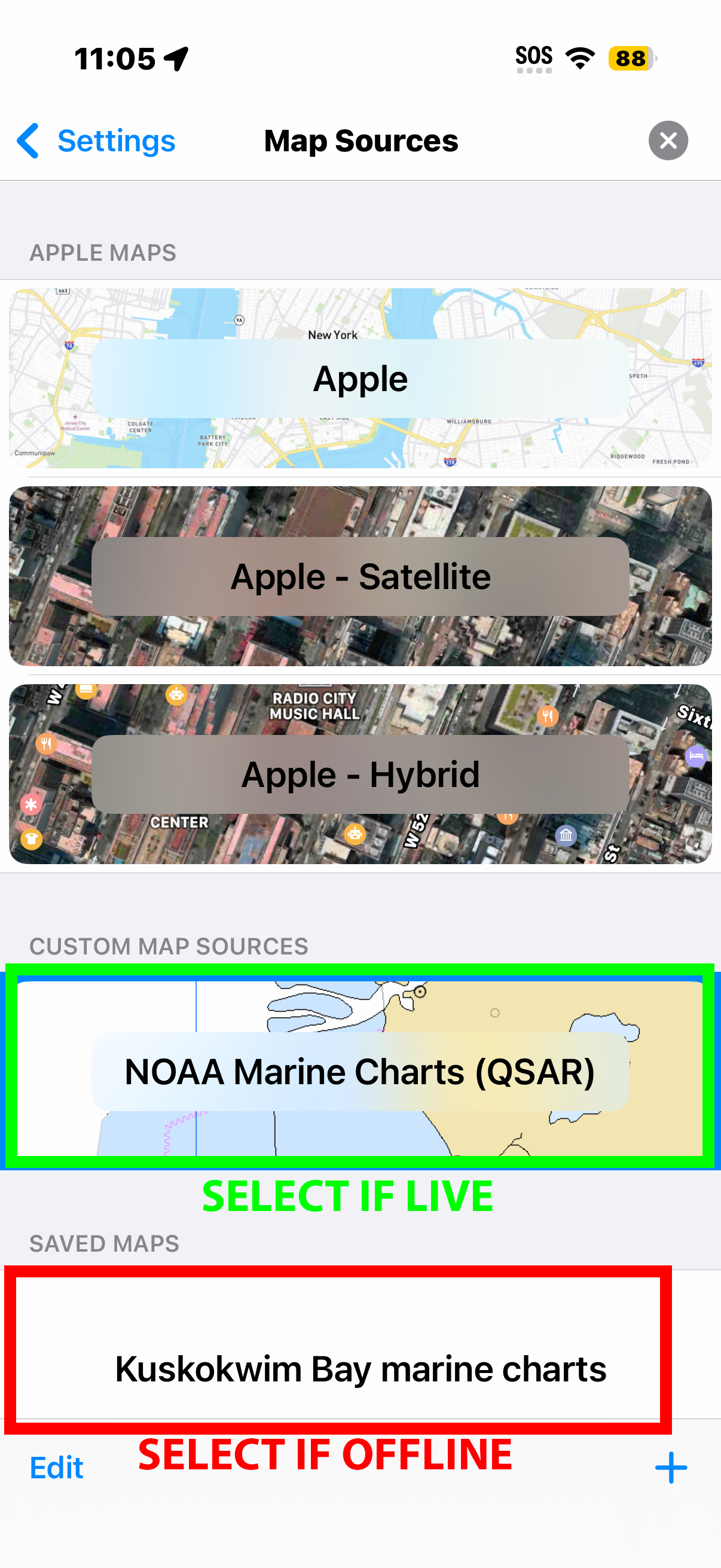
- In iTAK: map sources → Add a map source → browse to
Files → Downloads → pick
qsar-noaa-enc.xml. - Select NOAA Marine Charts (QSAR) from the map list.
Tiles stream from the server as you pan — so this needs internet.
iPhone (iTAK) — offline charts (for boat trips)
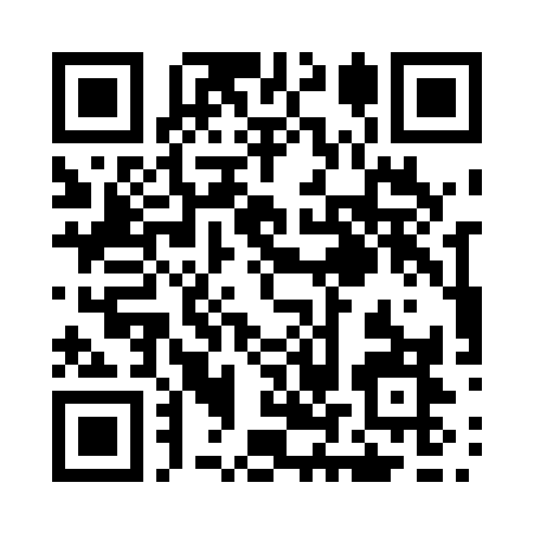
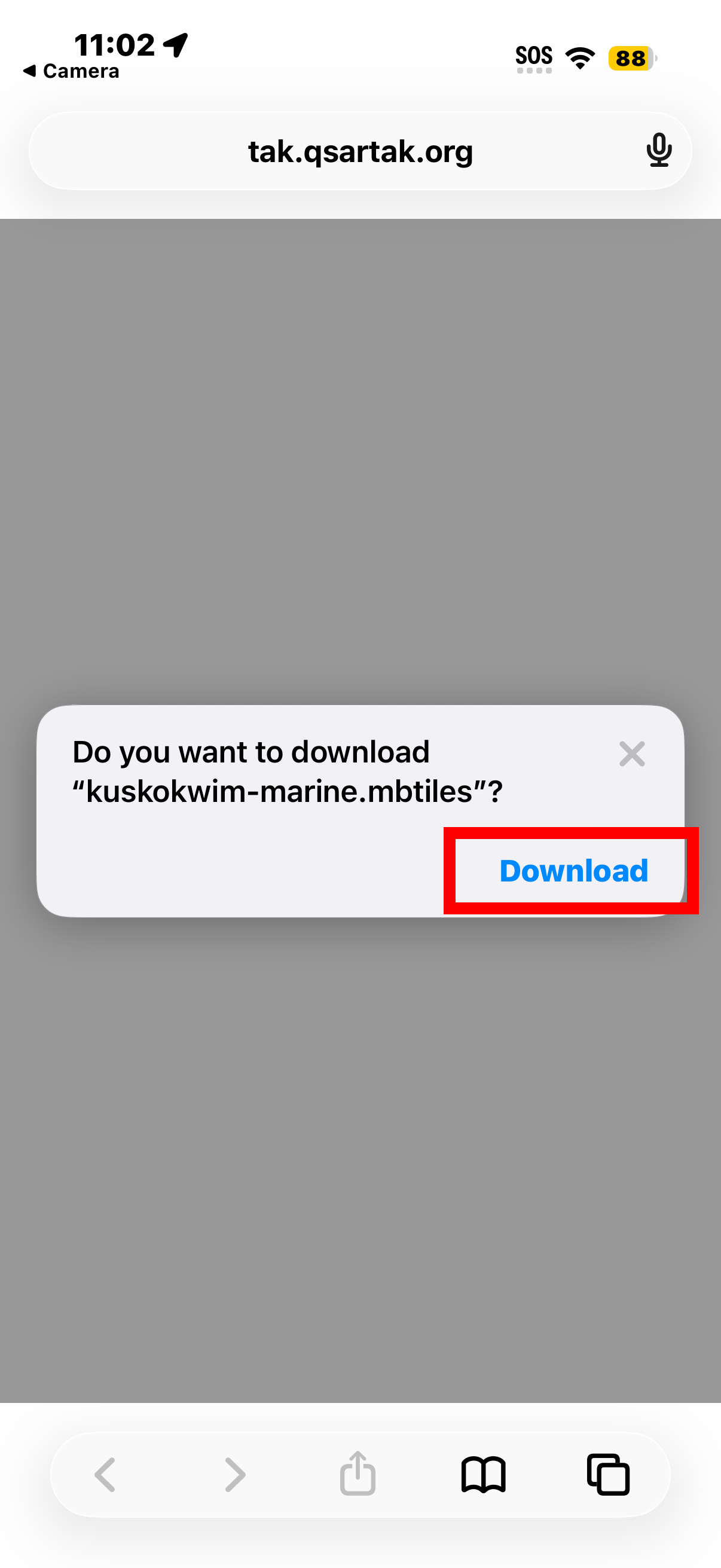
- Scan the QR above (or open https://tak.qsartak.org/offline/kuskokwim-marine.mbtiles) — the bundle covers all of Kuskokwim Bay (Quinhagak, Eek, and Goodnews Bay waters) and lands in Files → Downloads.
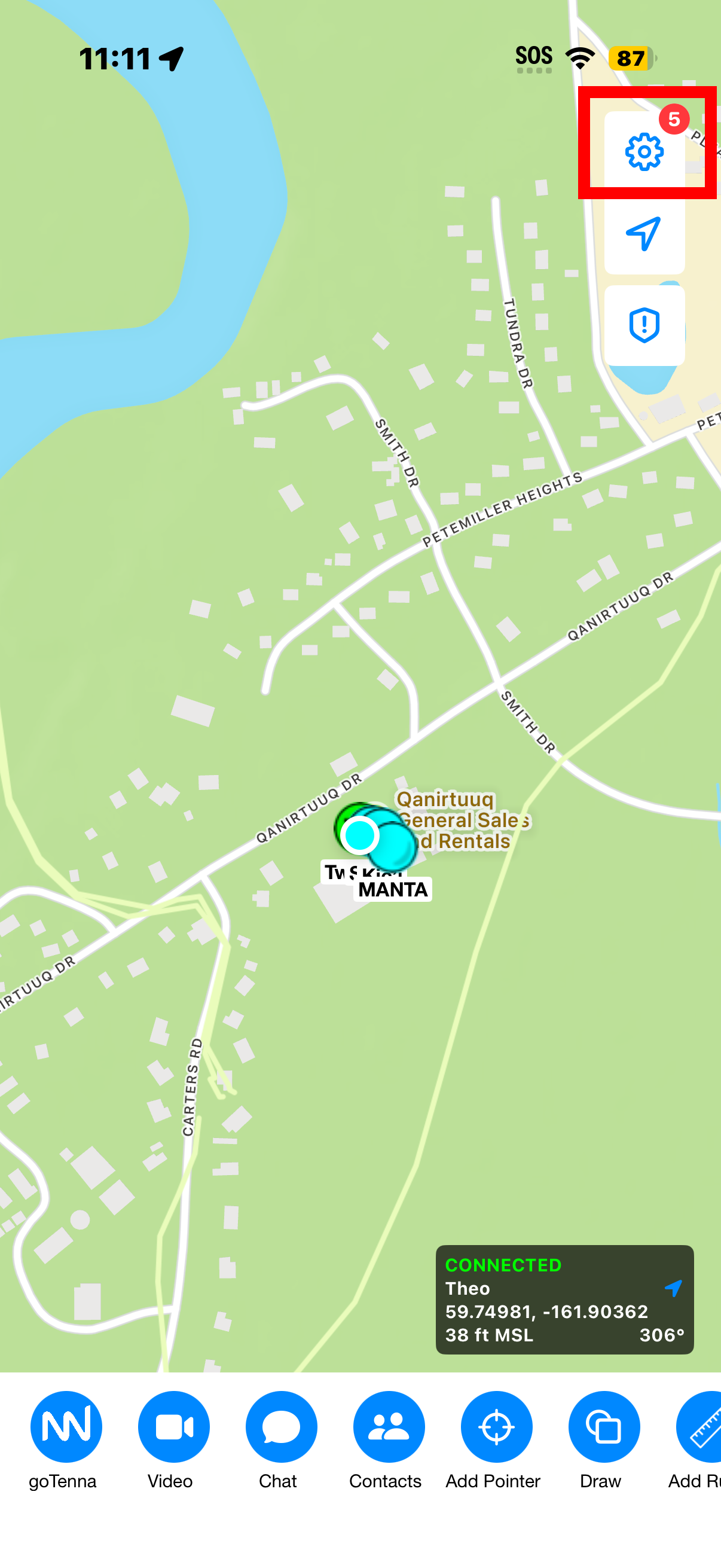
- In iTAK: map sources → Import saved maps → pick the downloaded
kuskokwim-marine.mbtiles. - Select it as your map. It now works with zero connectivity.
Do this before leaving the village — the file is sizeable and needs a good connection once. NOAA updates charts weekly; re-download the bundle a couple of times a season.
Click to view IOS (ITAK) Step-by-Step Screenshots
 |
 |
 |
 |
 |
 |
 |
Android (ATAK)
- Scan the same offline QR above (or download https://tak.qsartak.org/offline/kuskokwim-marine.mbtiles).
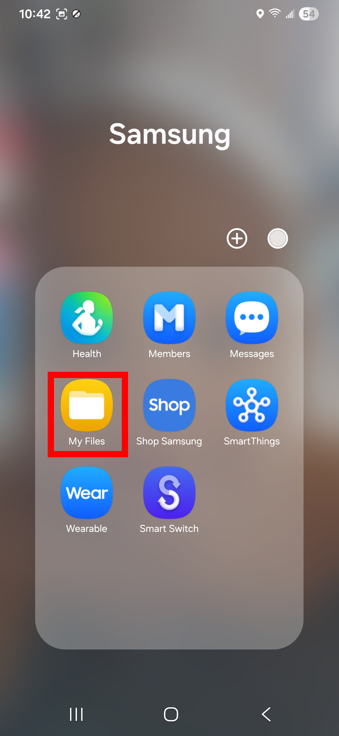
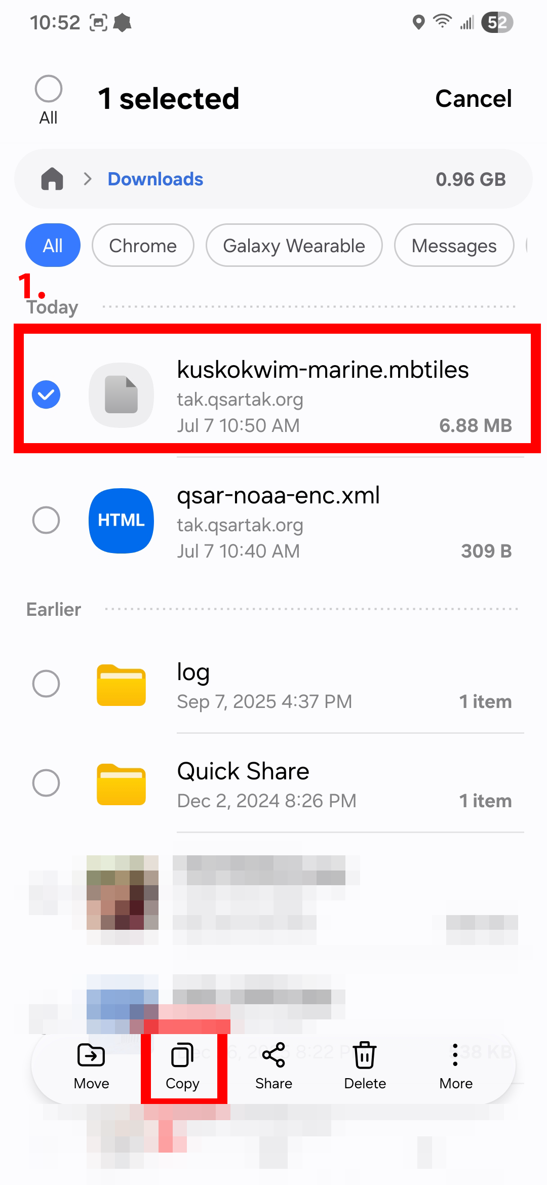
- Open the My Files app, select the downloaded
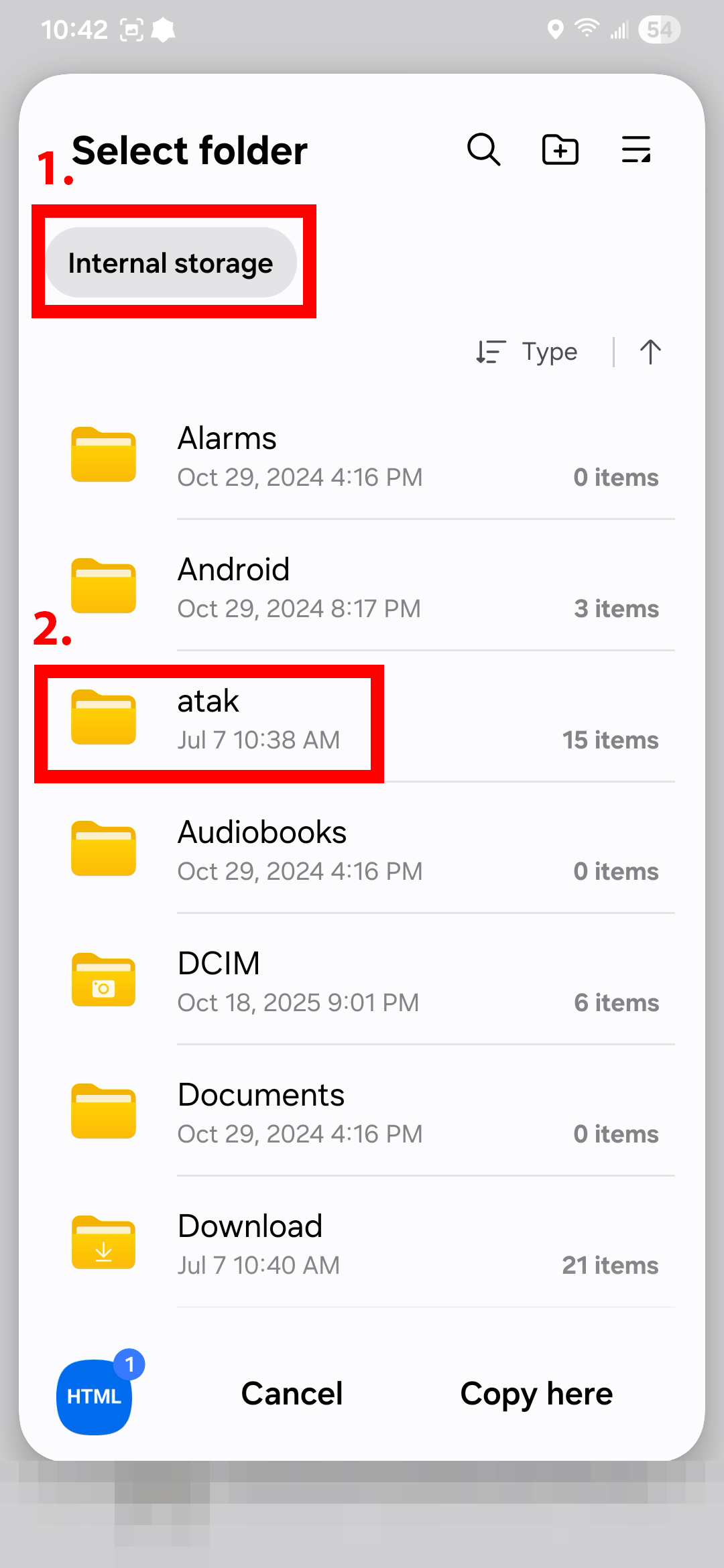
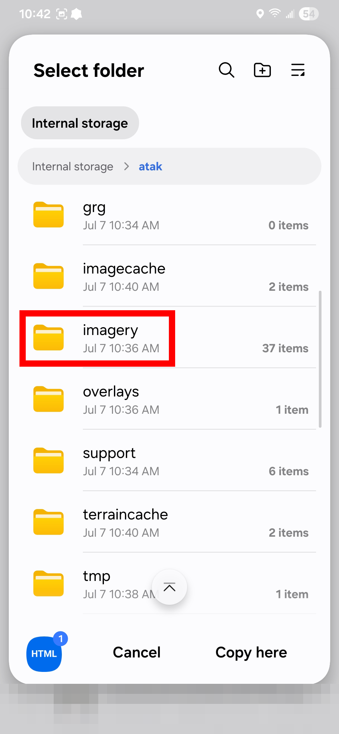
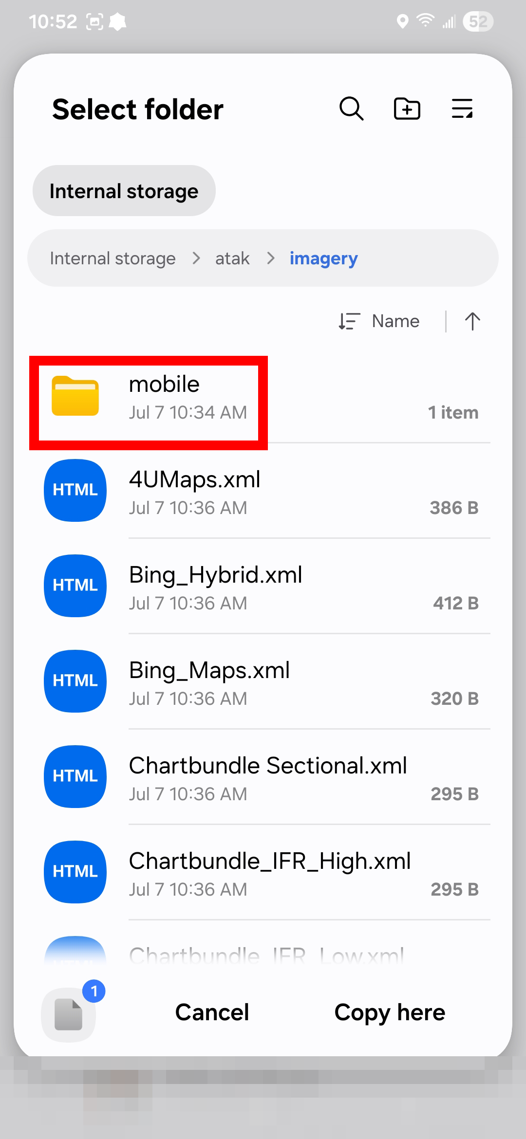
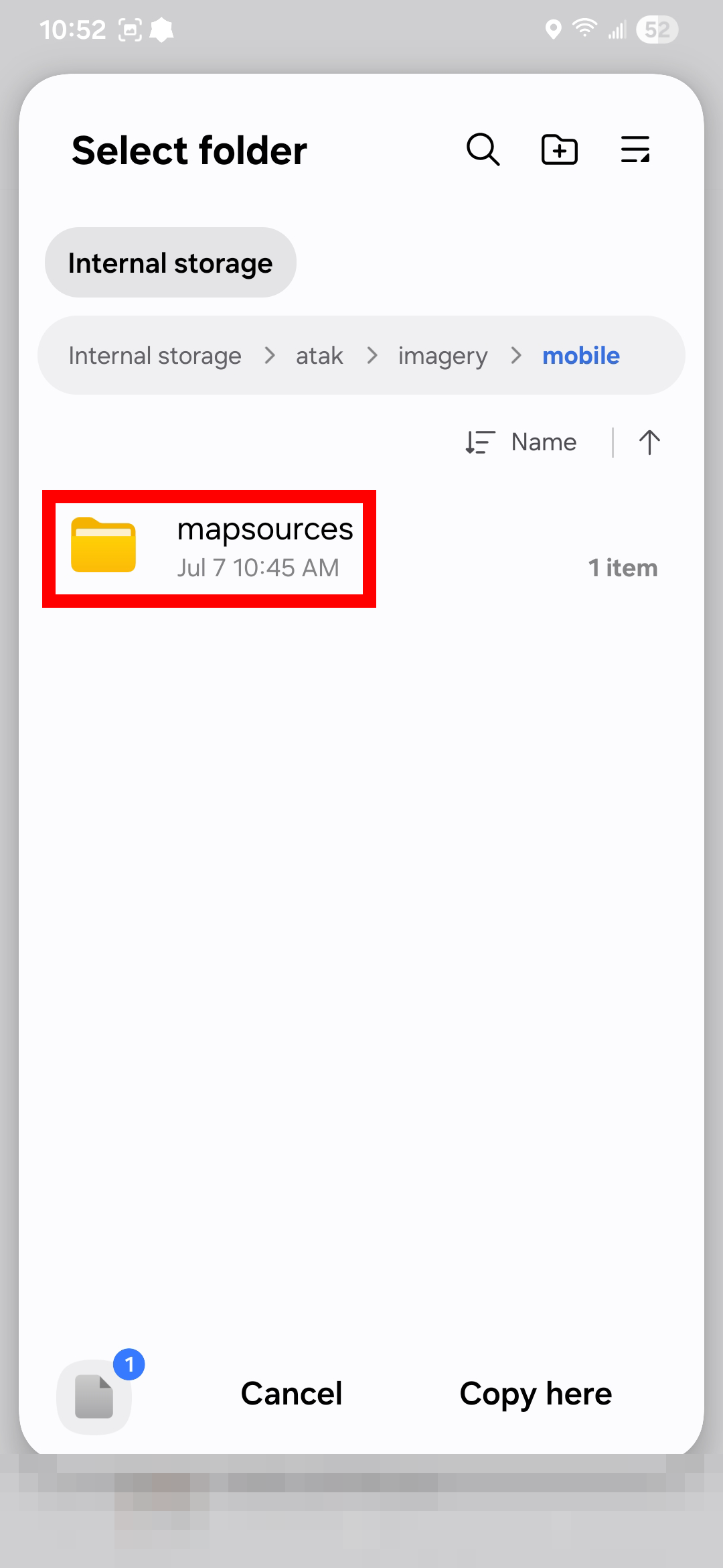
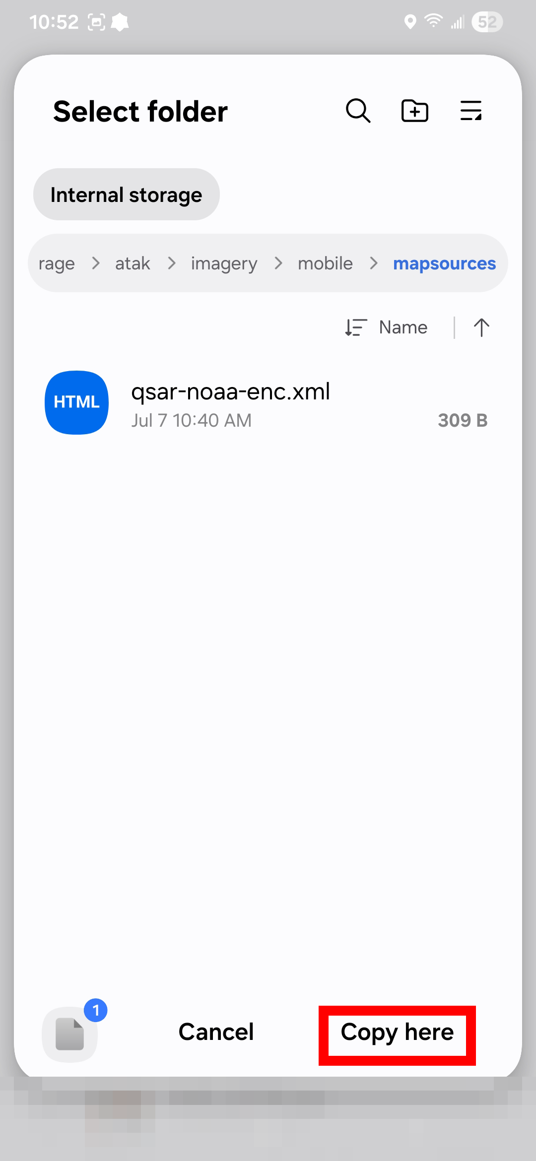
kuskokwim-marine.mbtilesfile and select Copy. - Navigate to Internal storage → atak → imagery → mobile → mapsources and press Copy here.
- Re-open the ATAK app.
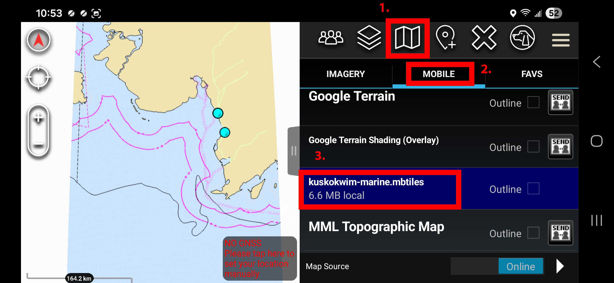
- Map-selection icon (folded map, top right) → Mobile tab → kuskokwim-marine.mbtiles.
Do this before leaving the village — the file is sizeable and needs a good connection once. NOAA updates charts weekly; re-download the bundle a couple of times a season.
Click to view Android (ATAK) Step-by-Step Screenshots
 |
 |
 |
 |
 |
 |
 |
Saving other imagery for offline use (Android / ATAK)
The QR downloads above hand you a finished offline file. ATAK can also save imagery itself — you pick an area on the map, pick a zoom range, and it caches the tiles of whatever live map source you’re on, so that area keeps working with no signal. Use this for the satellite and topo layers, where we don’t ship a pre-built bundle.
This is the standard ATAK workflow, so rather than re-write it, here is COTAK’s official tutorial (the Colorado statewide TAK program — same app, same menus):
Three things to keep in mind for QSAR:
- Do it in the village, on Starlink. Caching tiles downloads real imagery — it is slow and large. Nothing about this works once you’re out on the tundra or the water; that’s the whole point of doing it early.
- Only cache our own map sources. Google, Bing, and Esri layers show up in most map-source packs off the internet, and their licenses forbid saving tiles for offline use. QSAR imagery comes from the State of Alaska and NOAA, which we are licensed to hand out offline. If a map source didn’t come from the QSAR server, don’t cache it.
- Zoom range is the size dial. Every extra zoom level roughly quadruples the download. Cache tight around where you’re actually searching, not the whole bay at max zoom.
Menu wording shifts between ATAK versions, and the video is a couple of years old. If a tap in it doesn’t match your screen, tell the admin what you see and we’ll pin the steps to your version.
Reading the charts
- White = surveyed water; soundings are in feet or fathoms depending on the chart (check the chart’s own labels).
- Blank/tan at high zoom means NOAA has no detailed survey there — common in our waters. It does not mean the water is safe.
- Charts refresh weekly from NOAA (that’s NOAA’s own update cycle).