
QSARshared live map
Quinhagak Search and Rescue · Yukon-Kuskokwim Bay, Alaska

One shared
live map

Local Search and Rescue teams are the first to respond in rural Alaska when someone goes missing. Our solution brings real-time situational awareness to these first responders to support better prehospital outcomes for patients in disconnected and GPS-denied environments.

Built on TAK: the mapping system used by the DoD and first responder teams nationwide. Live since July 2026.
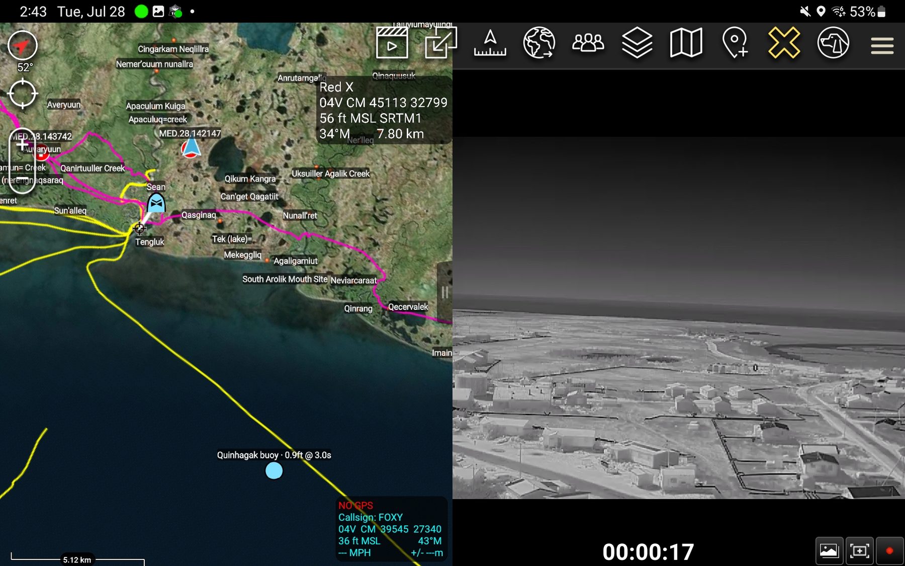
ATAK split-screen on a tablet: the left half is a map of the Quinhagak coast labelled with Yup'ik place names, marked trails, team markers and a wave-buoy reading; the right half is a live black-and-white thermal video feed of the village from an X10 dock drone.
ATAK on a tablet in Quinhagak: Yup'ik place names and community-collected snowmachine trails on the left; the Quinhagak buoy reporting 0.9 ft at 3.0 s, and the live thermal feed from an X10 dock drone on the right.
On the map today
  • Shared servertak.qsartak.org
  • PhonesiPhone + Android enrolled
  • Satellite beaconsfield-tested over Iridium
  • Wave buoysreporting every 15 min
  • Marine chartslive + offline bundles
  • Drone videostreamed from the X10
What the team actually sees

Real screens from a Quinhagak-based Search and Rescue with position overlays in Skydio Cloud and ATAK.
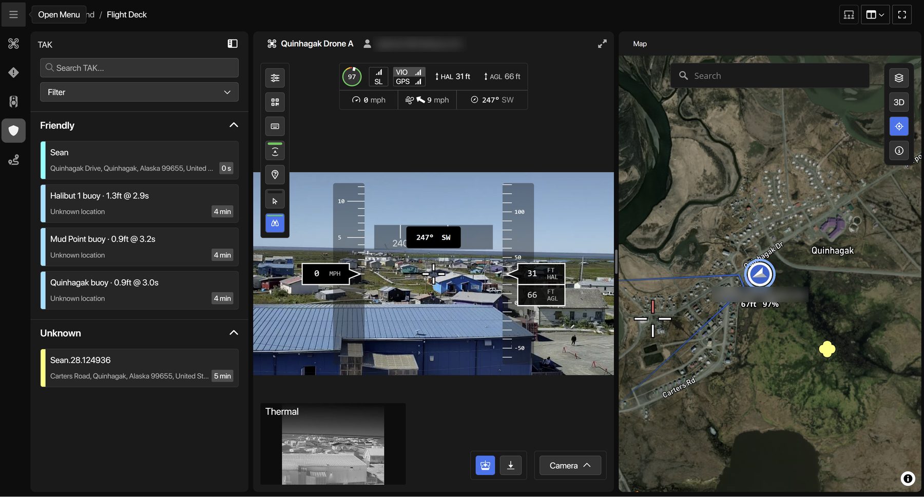
Skydio Flight Deck with the TAK panel open, listing team members and three wave buoys, alongside the drone's live camera view and its position on a map of Quinhagak.
Flight Deck · operations view An Incident Command Coordinator's screen. Team members and all three wave buoys report into the TAK panel on the left. UAS video and telemetry (i.e., location) feeds are pushed to teams, state, and federal agencies.
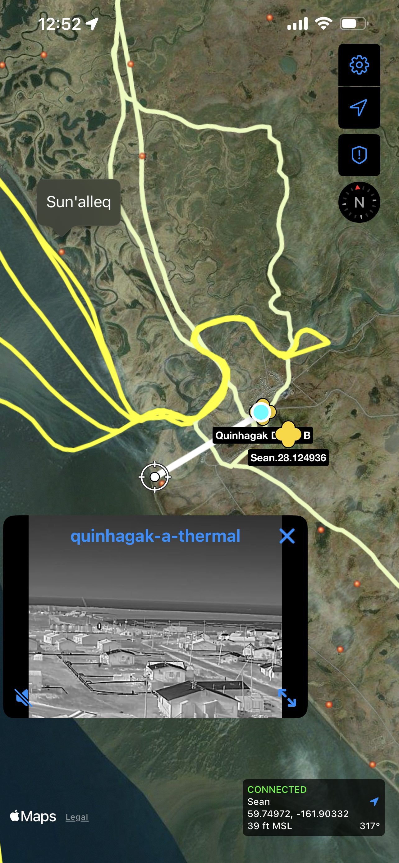
iTAK on an iPhone showing the Quinhagak coastline, yellow snow-machine trails, a drone marker labelled Quinhagak Drone B, a team member marker, and a thermal video window.
iTAK · iPhone The same picture in a searcher's pocket. Marked trails and the Sun'alleq site sit under the drone's own marker, and the X10's thermal camera plays in the corner. Bottom right is this phone's own position, reporting back to the team. All mission tracks are automatically saved and exportable as KML.
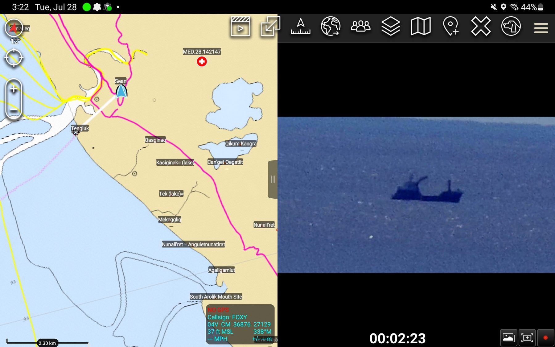
ATAK split-screen: a NOAA chart of the Arolik coast labelled with Yup'ik place names on the left, and on the right a live zoomed camera view from the drone showing a tender vessel on open water.
ATAK · 128× optical zoom The same feed, zoomed. The located vessel is approximately six miles from the UAS, and the feed is streamed live to search parties and Incident Command. On the left, the map provides coordinates and a Yugtun placename.
How Do We Connect Rural Alaska?
  1. 1
    Every phone becomes a map. Searchers install a free app — ATAK on Android, iTAK on iPhone. Everyone sees everyone.
  2. 2
    The drone joins the map. Skydio X10 video and position stream to the same map, so the whole team sees what the camera sees.
  3. 3
    Beacons cover the dead zones. Satellite Personal Locator Beacons (PLBs) keep searchers on the map with no cell signal and no internet.
  4. 4
    Starlink ties it together. Starlink Roam kits are issued to each SAR response team, connecting each party to a shared server in the cloud.
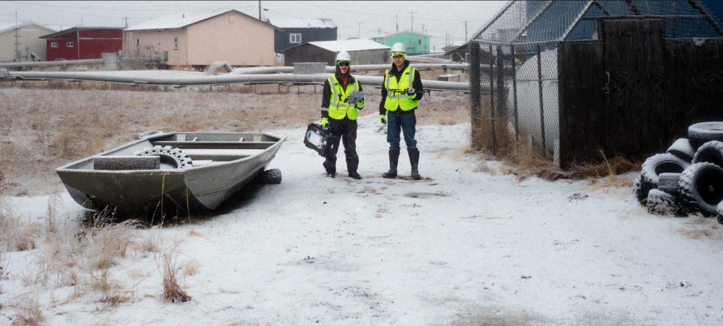
Two volunteers in high-visibility vests carry a drone case across snow-covered ground in Quinhagak, with village houses and a skiff behind them.
Heading out to fly. Our kit travels in a small Pelican case and our map travels on everyone's phone.
Calling for help: the 9-line

When someone is hurt, the hard part is saying exactly where they are and what shape they're in. ATAK's CASEVAC form does both without a word of radio description.
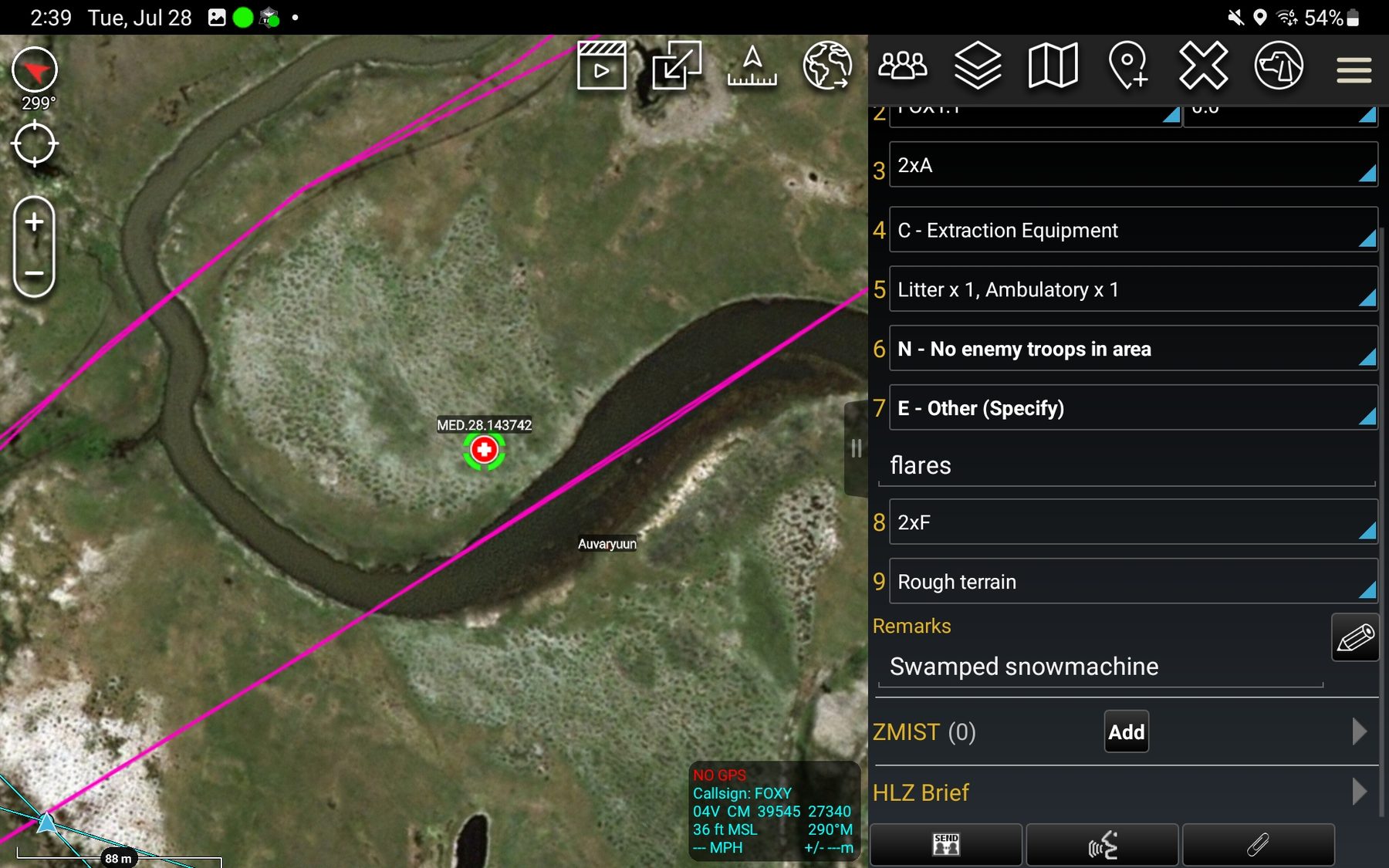
ATAK on a tablet: a CASEVAC nine-line form filled out on the right with extraction equipment, litter and ambulatory counts, terrain and the remark 'Swamped snowmachine'; on the left a satellite map with a casualty marker on a river bend, a magenta snow-machine trail overlay and the place name Auvaryuun.
ATAK · CASEVAC request The nine numbered lines carry the pickup: location, how many patients, litter or ambulatory, what equipment the extraction needs, what the terrain will do to a landing. The ZMIST panel underneath carries the patient — mechanism of injury, patient assessment, and treatment already given — so whoever is coming knows before they arrive. Because the request is a map object, the location is a point everyone already has. Unlike other ATAK integrations, our solution is tailored to local SAR teams. Here, our CASEVAC is placed near two snow-machine trails and a local placename.
Every callout on the record

A search generates information faster than anyone can hold it. The mission logger catches it as it comes in and keeps it after the team stands down. Tracks and mission data can be reviewed and edited, and updates pushed to team members in the field. All mission data is archived for future reference.

Opening a callout in the operations portal.
  1. Name the callout and start it. The clock starts with the mission, not with whoever remembers to write it down.
  2. Fill the lost-person report as you learn it. Identity, clothing, health, last seen, trip plan, vehicle — the questions a searcher would think to ask, already asked. More than one subject if the boat had more than one aboard.
  3. Tap the last known point on the chart. The coordinates fill themselves in, on the same NOAA chart the boats are using.
  4. Everything saves. Tracks are captured before the server ages them out, and the record downloads as KML or GeoJSON for review afterward.
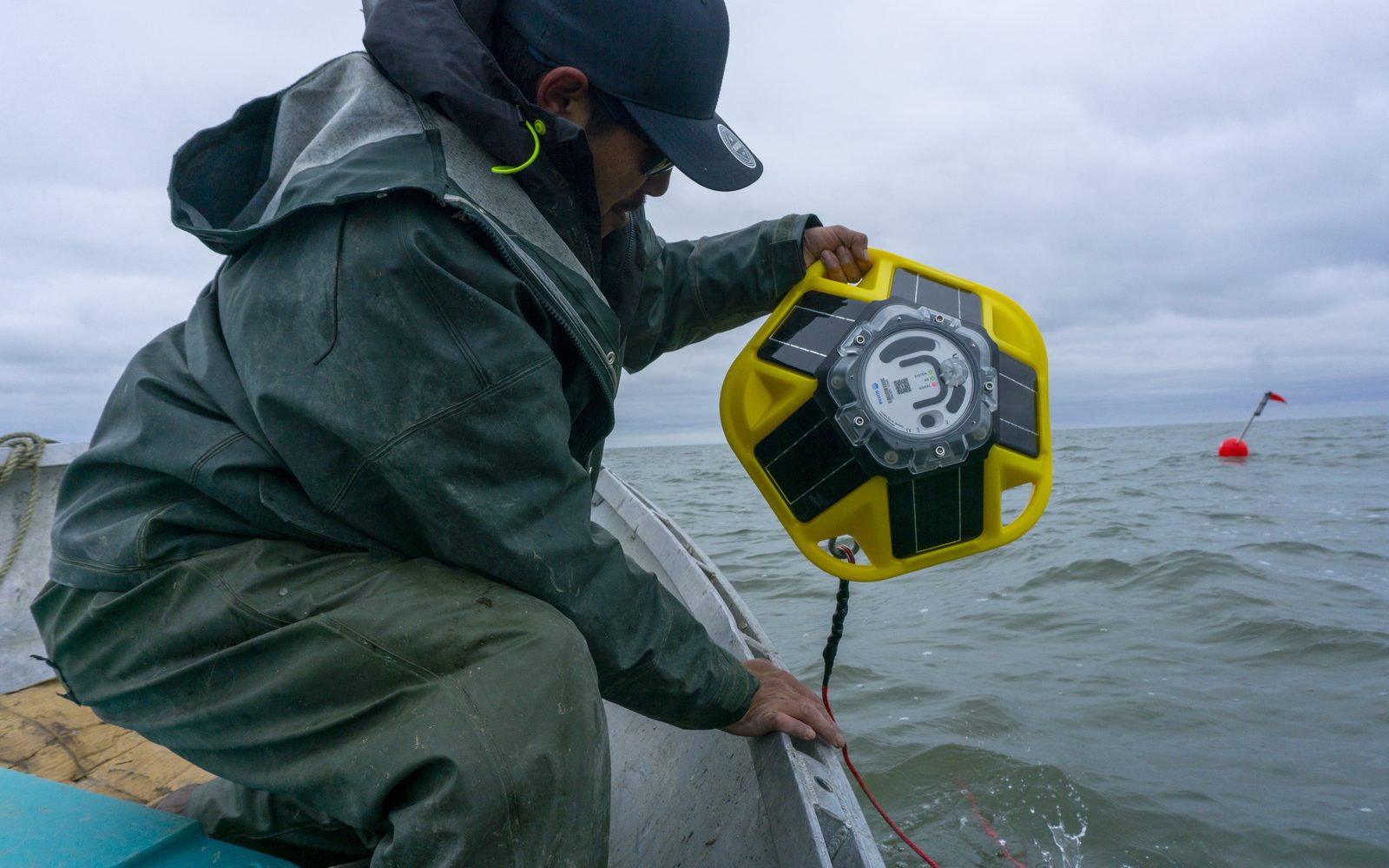
Three buoys in Kuskokwim Bay
A person in rain gear leans over the side of a skiff to lower a yellow Sofar Spotter buoy into Kuskokwim Bay, with a red marker buoy floating in the distance.
Deploying a Spotter buoy off Quinhagak. They go in when the ice clears and come out before it returns.

Before a boat leaves, the question is always the same: what is the water doing out there? Three wave buoys anchored along the subsistence corridors answer it directly — wave height, period, and temperature, reported to the same map every fifteen minutes. No calling around to Goodnews Bay and Kongiganak to guess at the weather in between.

“It’s actually a dream coming true, where we’re having the tools to help us with searching or subsistence traveling.”

Warren Jones, CEO, Qanirtuuq Incorporated

KYUK · May 23, 2025 Technology supports tradition in Quinhagak ocean buoy project
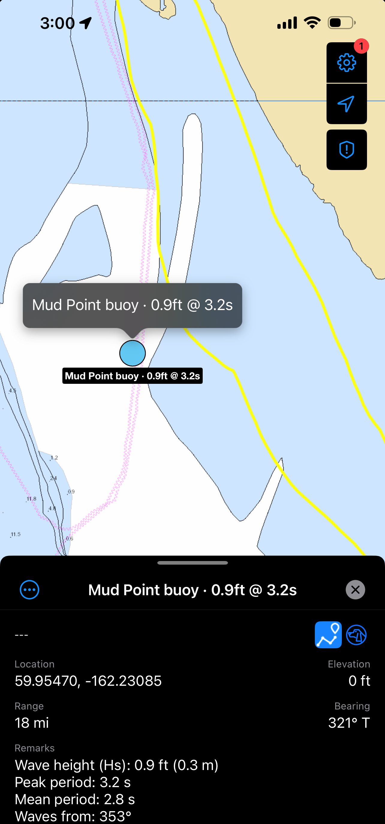
iTAK on an iPhone showing the Mud Point buoy on a NOAA nautical chart, with its detail panel open listing wave height 0.9 feet, peak period 3.2 seconds, mean period 2.8 seconds and wave direction.
iTAK · buoy readout Tap a buoy and the full reading opens on the chart — wave height, peak and mean period, direction, and water temperature, 18 miles out.
Local knowledge, on the map
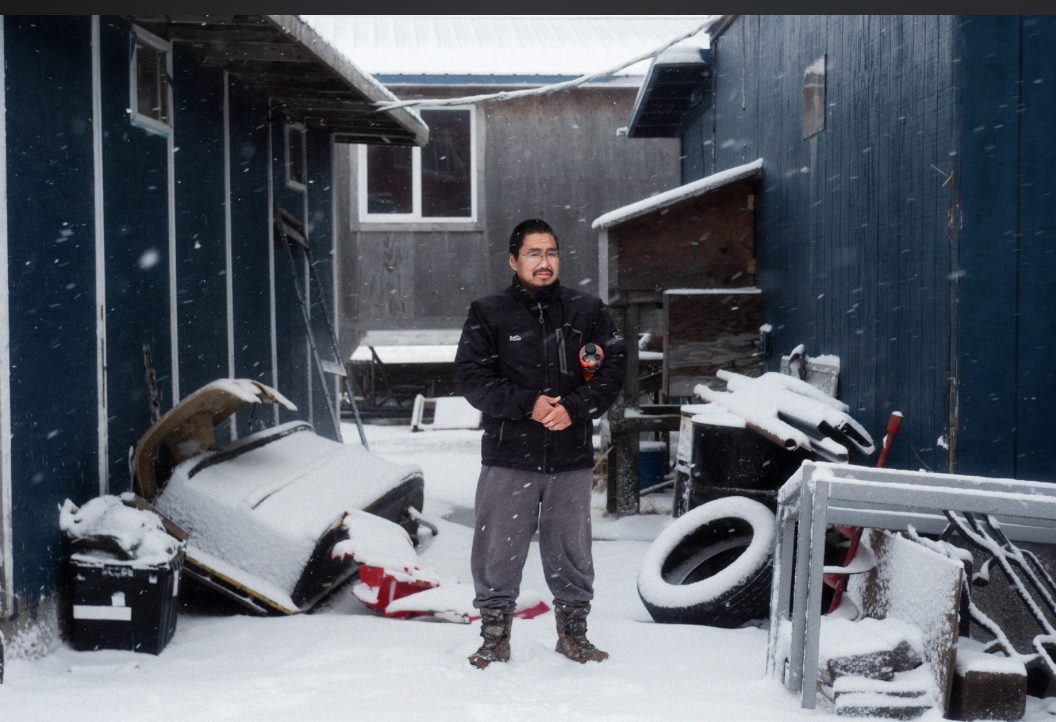
Cik Mark stands in falling snow in a yard between two blue buildings, among a snow-covered sled, tires and stacked gear.
Cik Mark, one of the volunteers mentoring the next group of searchers.

“It changed the river and the coastline. It’s a different land.”
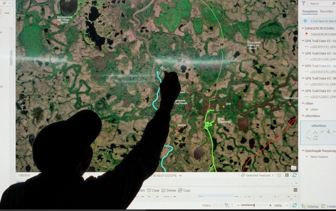
Cik Mark, search and rescue volunteer
A person in silhouette reaches up to a projected satellite map of the Kanektok River area, tracing a river channel among labelled Yup'ik place names.
Residents and search and rescue mentors add ancestral landmark names to the regional maps.

“We get weekly calls for search and rescue — weekly. Sometimes three times a week. Sometimes every day.”
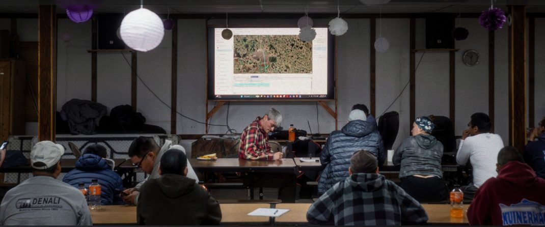
Byron Petluska, search and rescue volunteer
A full room of trainees seated at long tables watching a projected mapping session in a Quinhagak community hall.
Drone and search and rescue training for students from Quinhagak, Eek, and Goodnews Bay.

“At first when I came here, I thought it was going to be pretty hard. But it’s pretty easy.”
Angelina Olrun, drone trainee
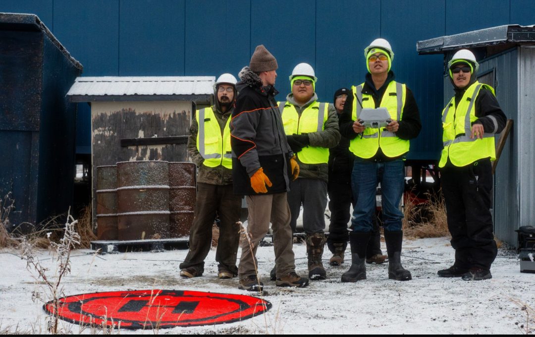
Six Quinhagak Search and Rescue members in high-visibility vests and hard hats stand in the snow around a drone controller, with a landing pad in the foreground.
Volunteers from all three villages qualifying on the X10.

“If you’re a local pilot, you’re gonna know your traffic patterns better than anyone who’s outside.”

Sean Gleason, drone training instructor

Photographs: Nalaquq, LLC.

KYUK · July 14, 2026 Quinhagak locals bridge drones and traditional knowledge. Now, they’re teaching others how to do it